Eight Regional Councils, in partnership with their Territorial Authorities and others, have applied for and will receive NZ$14 million of co-funding from the Provincial Growth Fund (PGF) to obtain LiDAR (Light Detection and Ranging) elevation datasets. Source: Timberbiz
Land Information New Zealand (LINZ) is managing this initiative on behalf of the Provincial Development Unit (responsible for administration of the Government’s Provincial Growth Fund) following an announcement that the Provincial Growth Fund will invest up to NZ$19 million to expand 3D mapping in the regions.
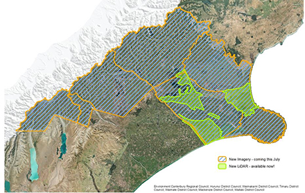
The eight regions which will receive co-funding from the Provincial Growth Fund are Waikato, Bay of Plenty, Hawke’s Bay, Tasman, Marlborough, Canterbury, West Coast and Southland. The first round of applications for co-funding closed on 1 March 2019.
The LiDAR capture proposed in the eight applications will provide data for over half of New Zealand’s land area.
Once the initiative is complete, New Zealand’s total LiDAR coverage should increase to approximately 80%, from 10% currently.
“The elevation data captured by LiDAR supports the regions to make critical infrastructure investment decisions and prepare their communities and industries for climate change,” Jan Pierce, Deputy Chief Executive, Location Information, LINZ said. “It’s also crucial for urban planning, construction and engineering.”
According to Robert Pigou, head of the Provincial Development Unit having highly accurate land information also supports good planning and decision-making by industries looking to invest in the regions, particularly in the agriculture and forestry sectors.
LINZ will soon issue a request for tender to select aerial survey companies for data collection. A second round of co-funding, with applications due 28 February 2020, allows more time for other councils to prepare co-funding applications.
Elevation data products created through the project will be available as open data through the LINZ Data Service.


