Landslides can cause substantial environmental, social and economic impacts. Under future climate scenarios the frequency of landslide-triggering events is likely to increase. Land managers urgently require reliable high-resolution landslide susceptibility models to inform effective landslide risk assessment and management. Source: Timberbiz
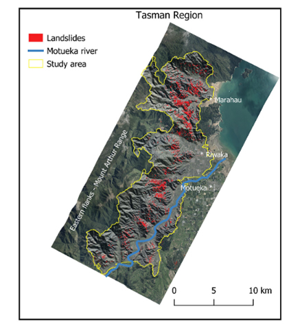
In a study titled Increased forest cover and limits on clear-felling could substantially reduce landslide occurrence in Tasman, New Zealand, gridded rainfall, topography, lithology and land cover surfaces were used to develop a high-resolution spatial model of landslides that occurred in Tasman, New Zealand during a period when ex-tropical Cyclone Gita brought heavy rain to the region.
The team of three, James Griffiths of the Department of Conservation, Claire Lukens of Victoria University and Roger May of Tomorrow’s Forests modelled landslides in the same dataset as a function of the erosion susceptibility classification (ESC) data layer used to determine the level of control applied to forestry activities under the National Environmental Standards for Plantation Forestry (NES-PF).
The study shows that accurate, high-resolution landslide probability surfaces can be developed from landslide distribution, land cover, topographical and rainfall data. It also showed that landslide occurrence in the Tasman region could be substantially reduced by increasing the extent of permanent forest cover and by limiting clear-fell harvest of plantation forests on landslide-prone slopes.
The paper and more information is available at
https://nzjforestryscience.nz/index.php/nzjfs/article/view/94


