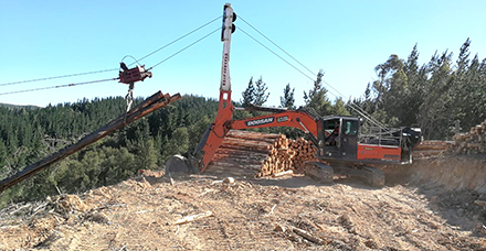
Softree Technical Systems a producer of forest road and engineering software, announced the release of RoadEng Version 9. This updated version offers a variety of new features for planning cable harvesting operations. Source: Timberbiz
Cable harvest planning and analysis using RoadEng 9 can help determine landing locations and road infrastructure.
Working off of a high-resolution digital terrain model (such as LiDAR), users can simultaneously explore multiple areas for deflection for cable harvesting suitability and conduct payload analysis.
Harvest planners can review the potential locations in plan, profile, and in data views, allowing them to better determine optimum locations.
“We are seeing a huge increase in investments in LiDAR data across our forestry industry customers” Erin Wasney, Business Development Manager at Softree said.
“Version 9 has some key improvements to enhance LiDAR-based planning of cable harvesting operations. You can now plan your roads and cable locations together in conjunction with each other.”
Improved Cable Harvesting Planning Capabilities:
- Creation of very large digital terrain models from LiDAR.
- Cable Analysis “Explore-Mode” with colour-coded display of areas of deflection. Simultaneously explore multiple areas for deflection / cable harvesting suitability.
- Calculation and display of loggable area polygons.
- Automatic calculation of tail station location.
- Enhanced profile display for cable setups.
- Improved field usage with GPS Integration.
RoadEng 9 runs on a Windows tablet, which means users can bring the full engineering program with them to the field.
The new version also includes an easier user interface and touch gestures which makes working with RoadEng on a tablet easier than in previous versions.
Furthermore, GPS integration means users can track their location in the field while visualizing their LiDAR data and planned cable harvesting locations. This makes visualization and field verification easier than ever before.