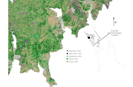
Researchers at Manaaki Whenua – Landcare Research, New Zealand’s Crown Research Institute for land and environment, have produced the first map of individual kauri trees in New Zealand, focusing initially on the 27,000-hectare Waitakere Ranges Regional Park near Auckland, in the hope of helping to identify where kauri trees are and better understand the spread of kauri dieback. Source: Timberbiz
Manaaki Whenua’s Advanced Remote Sensing of Aotearoa program, in collaboration with the Auckland Regional Council, has identified 28,424 individual kauri trees over 15 metres tall in the park and a further 5,708 giant trees that are upwards of 30 metres tall.
They found 1,173 trees over 15 metres have died or are currently dying, a higher number than the team expected to find.
“The map showed that this is a complex forest,” says Manaaki Whenua lead researcher Dr John Dymond.
“It seems as though there are many dead and dying trees around the periphery of the park where there are access roads and paths. If the affected trees are close to live kauri trees, then we can compare them and work out which are dying.”
Researchers used remote sensing method to combine data from LiDAR, aerial base multispectral imagery, and ground data to construct the map.
“We analysed and combined these data to get the results and information around the height, geometrical structure, branches and colour of the trees and leaves,” Mr Dymond said.